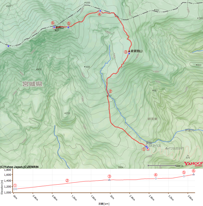
A beautiful mountain stream, a superb view from the mountain ridge - the Higashi Kurikoma Trail is easily one of the best hiking experiences in the area!
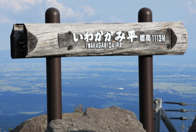
【Trail entrance】 Iwakagami-daira(Numakura, Kurikoma, Miygagi Pref.)
【Distance】 approximately 3.7km
【Altitude of trail entrance】 1,113m
【Altitude difference】 513m
【Total altitude difference】 approximately 539m
【Difficulty level】 physical endurance ★☆☆☆☆ technique ★☆☆☆☆ risk ★☆☆☆☆
【Other information】 No drinking water available on trail No dangerous places
【Phone reception】 Docomo strong signals au and Softbank weak signals
【General guide】
Higashi Kurikoma trail starts from Iwakagami-daira, very close to the start of the Central (Chuo) trail. The trail is very popular and it is one of the most amazing hiking trails on Mt Kurikoma.
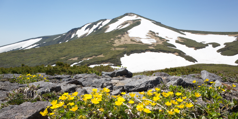
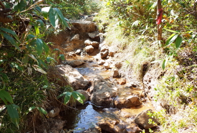
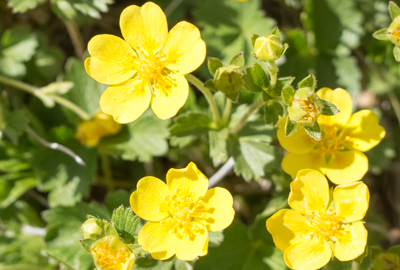
When enjoying the beautiful mountain stream Shin-yuzawa and the superb view on the ridge of Higashi Kurikoma, it’s not hard to see why this is a favourite trail! You can see a large spread of Miyamakinbai flowers (Cinquefoil) on Mt Higashi Kurikoma in May. This trail retains water for several days after rain, so it is best to hike it when the weather is fine.
Although many people use the Higashi Kurikoma trail the whole way around Mt Kurikoma, is another goal option taking the Higashi Kurikoma trail for your ascent and the Central (Chuo) trail for descent.
It’s often very windy and cold on the ridges of Higashi Kurikoma. Be aware of hypothermia’s signs, symptoms and treatment when hiking in the mountains. Hypothermia is the dominant cause of death in hiking.
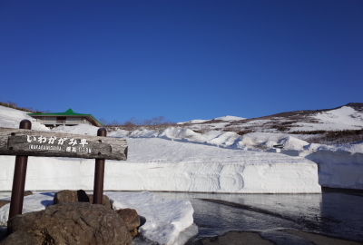
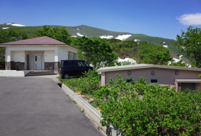
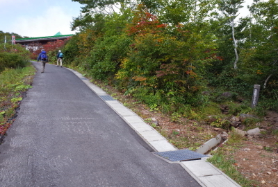
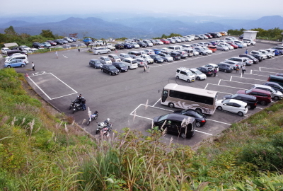
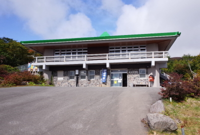
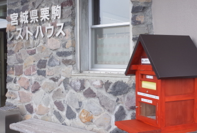
Iwakagami-daira parking lot from an altitude of 1,113 metersThe road to the parking lot is opened to traffic around Golden WeekThere are 3 parking lots at Iwakagami-dairaYou can see a wonderful view from IwakagamidairaPublic restrooms on the left, evacuation huts on the rightThe Higashi Kurikoma trail entrance is in front of the Central (Chuo) trail entranceThe Higashi Kurikoma trail entrance. The trail is not paved.The parking lots may be full in the early morning during peak seasonYou can get food and take a rest at the mountain hutDon’t forget to post your hiking plan
————————————————————————————————————————————————————————————
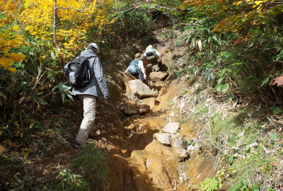
1.Iwakagami-daira trail entrance ~ 40min.(30min.)~ 2.Crossing point of the Shin-yuzawa mountain stream
————————————————————————————————————————————————————————————
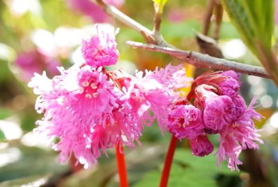
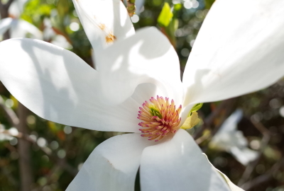
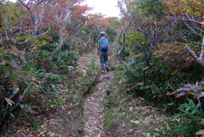
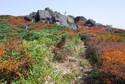
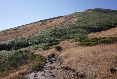
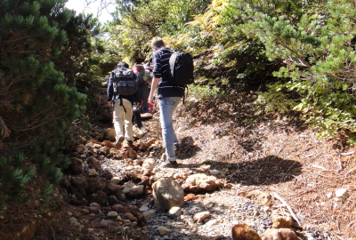
The trail is like a mountain stream after rainingIt is difficult to hike on the trail after rainThere are some steep rocks to climbThe first part of the trail is lined with bushesThe trail with beautiful autumn leaves in peak seasonLooking backwards, you can see the beautiful Ou MountainsFringed galax (Schizocodon soldanelloides)Anise magnolia
————————————————————————————————————————————————————————————
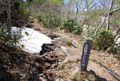
2.Crossing point of the Shin-yuzawa mountain stream ~ 20min.(15min.)~ 3.Mt Higashi Kurikoma
————————————————————————————————————————————————————————————
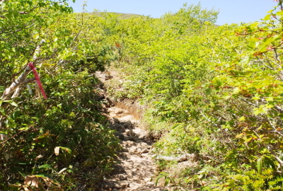
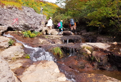
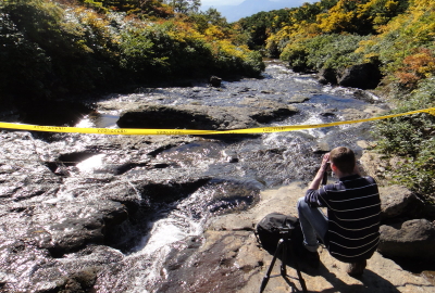
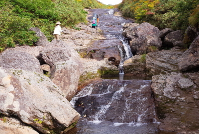
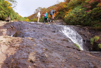
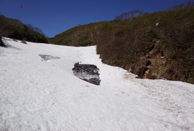
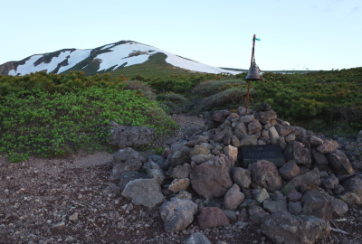
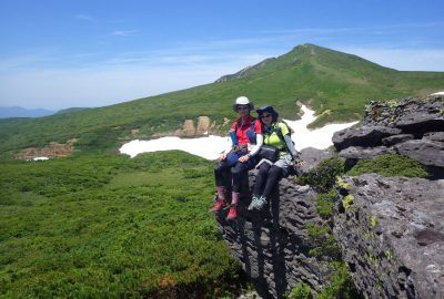
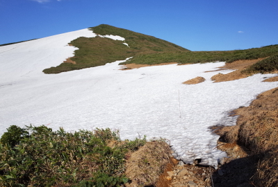
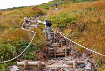
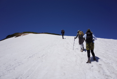
After 40 minutes, you can reach the Shin-yuzawa mountain streamWalk up along side the stream at this pointHike up along the mountain stream according to the signsAfter about 100m, rejoin the trail on the right hand sideThere is still some unmelted snow in early summerCrossing point of the Shin-yuzawa mountain streamAfter taking the trail for a while, there are good views you can seeThe trail is easy to hike and it’s slippery here so please be carefulAfter a short while, you can see Mt KurikomaThere is a small bell. Feel free to ring the bellYou can enjoy a superb view on the mountain ridge from hereA nice trailIt’s often very windy on the ridges of Higashi KurikomaYou can see a magnificent view of the Ou Mountains
————————————————————————————————————————————————————————————
3.Mt Higashi Kurikoma ~ 30min.(25min.)~ 4.Trail junction of Higashi Kurikoma and Uragake trail
————————————————————————————————————————————————————————————
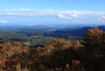
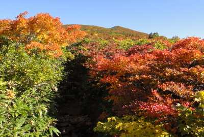
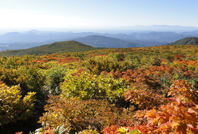
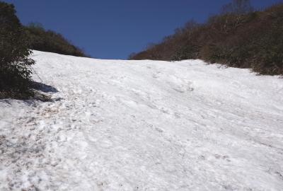
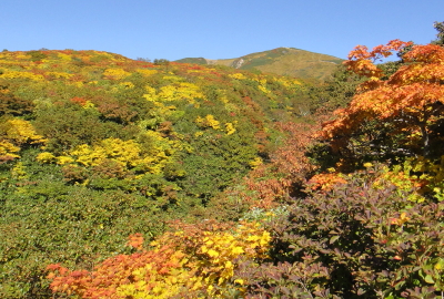
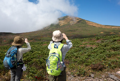
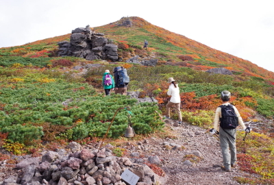
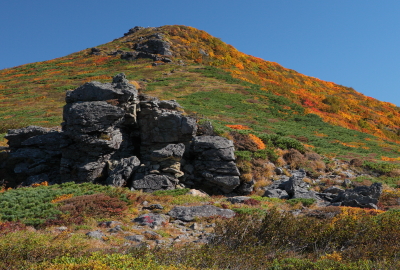
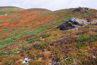
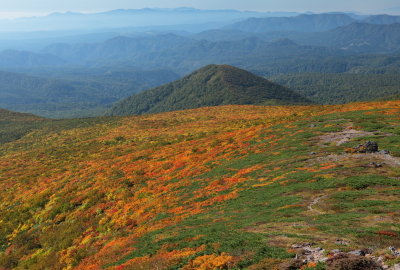
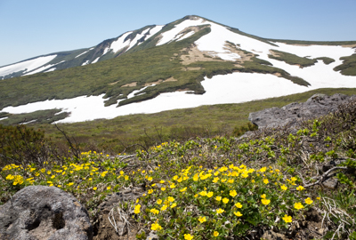
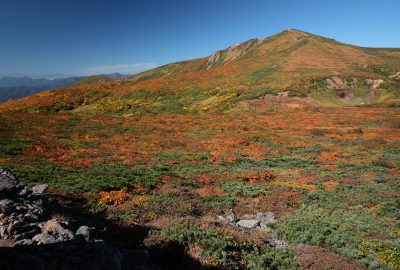
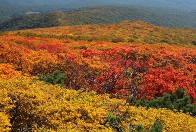
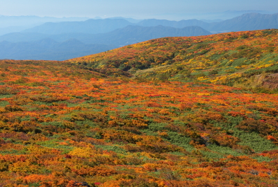
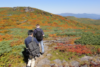
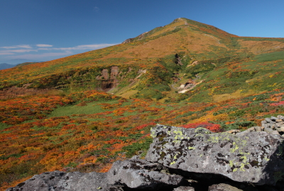
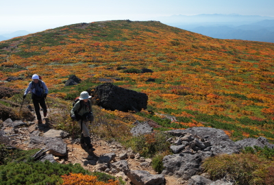
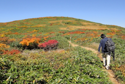
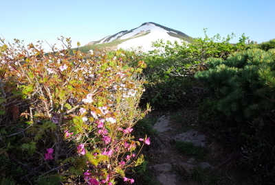
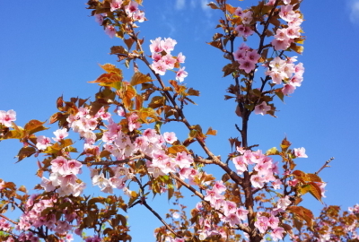
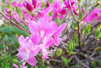
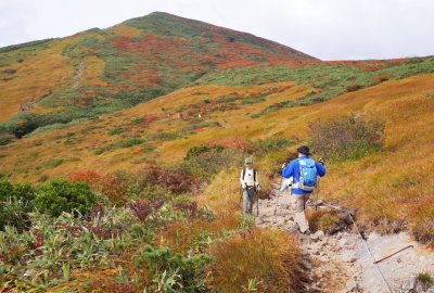
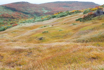
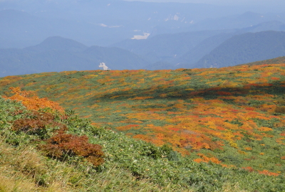
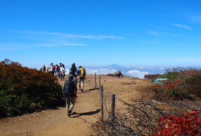
You can see Miyamakinbai flowers on Higashi Kurikoma in MayIt takes 20 minutes from the Shin-yuzawa to the Higashi Kurikoma summitIt is one of the most impressive views from Mt Higashi KurikomaView from peak of the Higashi Kurikoma trailView from the Higashi Kurikoma trail, the Central trail and mountainsThe trail is a gentle slope. It’s often very windy hereThe trail is a gentle slope. It’s often very windy hereThere are some large rocks on the ridges of Higashi KurikomaHikers on the Higashi Kurikoma trailView from on the ridges of Higashi Kurikoma in autumnView of Mt Higashi Kurikoma on the Higashi Kurikoma trailHiking up enjoying view of Mt Kurikoma and Kitakami MountainsJapanese alpine cherry and Rhododendron albrechtiiMelting snow creates a lot of puddles on the trails, waterproof boots are essentialThere is still some unmelted snow around JuneJapanese alpine Cherry (Prunus nipponica)Rhododendron albrechtiiMiyamakinbai (Cinquefoil)
————————————————————————————————————————————————————————————
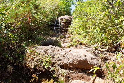
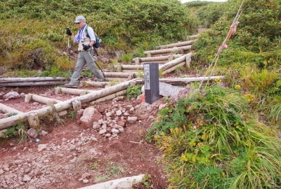
4.Trail junction of Higashi Kurikoma and Uragake trail ~ 20min.(13min.)~ 5.Trail junction of Central and Higashi Kurikoma trail
————————————————————————————————————————————————————————————
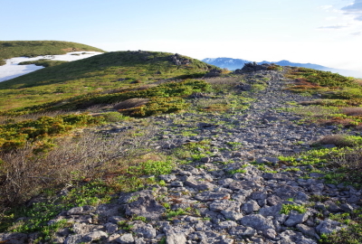
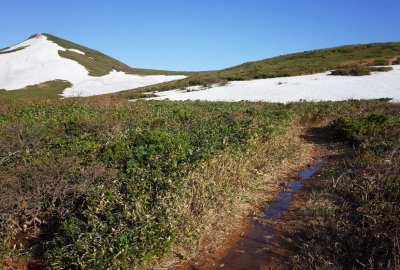
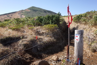
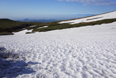
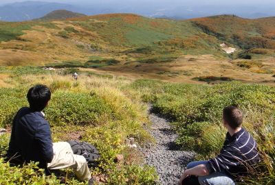
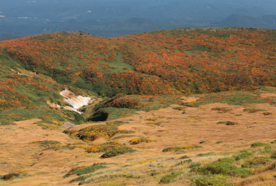
It takes 30 minutes from Mt Higashi Kurikoma to the next trail junctionYou walk on a gentle slope from the trail junctionThere is still some unmelted snow around JuneSome unmelted snow at the headstream of Shin-yuzawa in JuneFrom the headstream of Shin-yuzawaShelter here in case of weather changeIt is steep to the junction of the Central and the Higashi Kurikoma trailThere is a beautiful grassland at the headstream of Shin-yuzawaDon’t forget to rest as you go!You can enjoy a beautiful view of Iwate and Kitakami Mountains
————————————————————————————————————————————————————————————
5.Trail junction of the Central and the Higashi Kurikoma trail ~ 10min.(7min.)~ 6.Summit
————————————————————————————————————————————————————————————
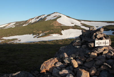
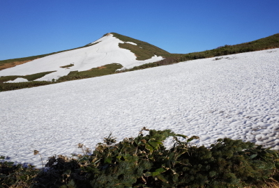
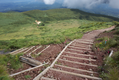
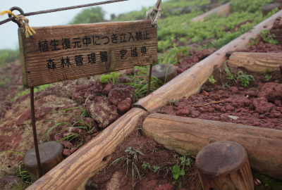
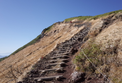
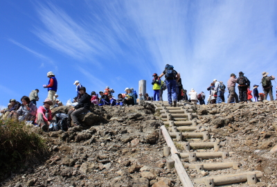
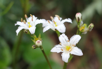
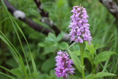
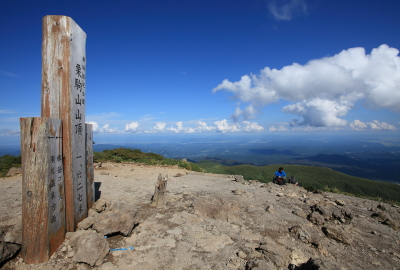
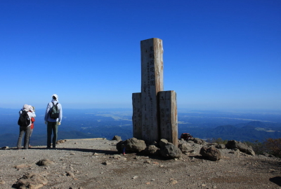
Trail junction, the Central (Chuo) and the Higashi Kurikoma trailTrail junction of the Central and the Higashi Kurikoma trailYou can see some mountains from the summitThere is still some unmelted snow until JuneView of a grassland around the Shin YuzawaPlease stay on established trails so as not to damage the flora hereThe trail is narrow and steepAfter climbing a steep slope, you can reach the summitNephrophyllidium (Nephrophyllidium crista-galli)Dactylorhiza (Dactylorhiza aristata)
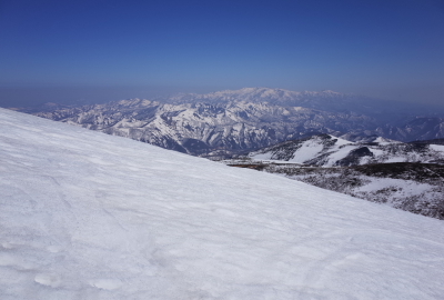
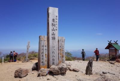
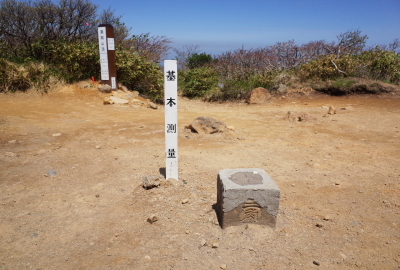
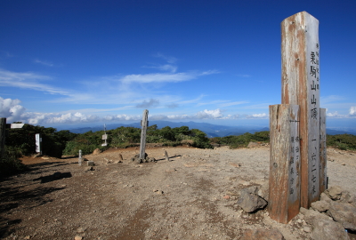
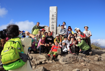
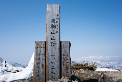
The summit of Mt Kurikoma with the markersA stone triangulation markerView of east (Iwate and Miyagi) from the summitView of west (Akita and Yamagata, Mt Chokai) from the summitView of south (Kurihara, Miyagi) from the summitView of north (Ichinoseki Iwate, Mt Yakeishi) from the summitThe summit is popular with a lot of hikers in high seasonThe summit just before hiking season